The powerful combination of LiDAR and multibeam data was used to maximum effect in this challenging hydrographic survey and mapping project. The aim was to gather volume measurements and map a dam and reservoirs to inform the planning of future dredging operations.
The resultant high resolution data enabled the silted reservoirs to be dredged efficiently, by enabling the Seabed B.V. team to identify areas of build up and to accurately determine the volume that needed to be dredged, to inform the dredging contractor pricing.
Rossière Dam – LiDAR and bathymetric data combined
Introduction
Seabed B.V., based in the Netherlands, specialises in the delivery of technical services and hardware and software development. Seabed B.V. focus on hydrographic survey projects, dredging operations and the offshore industries.
Groupe-E, a Swiss electricity supply company which owns and maintains numerous dams, contracted Hydrodam Industries, a Dutch company, to conduct dredging operations to relieve siltation towards the outlet of the Rossière Dam in Switzerland.
Hydrodam Industries offers worldwide total solutions for sediment problems relating to dredging, dewatering & treatment, mining and reclamation projects. Hydrodam Industries purchased a dredging registration system from Seabed B.V. to create a real-time representation and visualisation of the dredge head in QINSy. This was used to establish exactly where they had dredged and how much silt had been excavated. Seabed B.V. also provided consultancy and advice on the integration of the system to optimise the dredging effort.
In addition, Seabed B.V. helped to perform a hydrographic survey of two water reservoirs in the area, where the dredging operations would later take place. The aim of the surveys was to create a 360 degree visualisation of the area above and below the water level to develop an efficient and effective dredging operation plan.
Hydrographic survey location
The two small water reservoirs are located in Vaud, the third largest Swiss canton by population and fourth by its size. The Lac Du Vernex reservoir is located at an elevation of 895 metres above sea level between the Pointe de Cray and Planachaux mountains on the Saane/Sarine River at Rossiniere. A short distance away is another small lake called Lessoc, which was also surveyed.
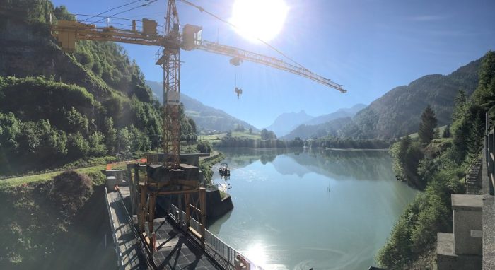
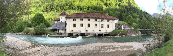
Rossière Dam built in 1972
Mobilisation
Seabed B.V. deployed the following equipment on a boat to survey the two lakes:
Sonar system: Norbit iWBMS
Positioning system: SGR6-D and RTK positioning for high accurate navigation data
Motion sensor: INS S2
Sound velocity: AML Base-X2
Laser sensor: Seabed iLiDAR sensor (Velodyne Puck)
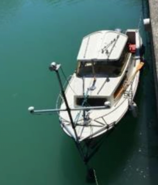
Equipment set up on the boat
Goal and challenges
The main aim of the survey was to gather volume measurements and spatial data to map the dam and surrounding reservoirs which would then inform the development of a detailed operational dredging plan.
A critical project challenge was the low water level in the reservoirs. In certain areas the water was deep enough to allow the survey boat close to the shore, approaching within 1m of the water’s edge, enabling a full bathymetric survey of the area to be undertaken. In very shallow areas, where the water level only reached 80cm, the boat access was restricted to around 10m from the coastline. This limited the bathymetric data that could be collected. In these challenging areas supplementing with the LiDAR data, collected using the Velodyne Puck (VLP-16) LiDAR scanner which has a usable range of about 75m, enabled the team to continue to collect detailed information above water level.
During the post-processing , fusing the LiDAR point cloud with the bathymetric data, the team was able to identify those areas where there was no bathymetric data, in particular the shallow water areas where the bathymetry system could not survey. These areas were then further processed to ensure a continuous terrain model was created of the whole reservoir enabling a better volume estimation to be undertaken.
Achievements
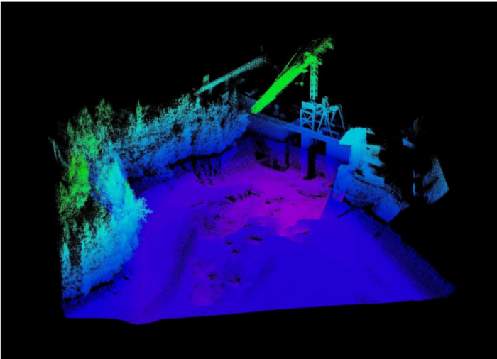
After post-processing the data the high resolution maps were created, which can be seen below and compared with the photographs taken by the survey team in the field. The combination of LiDAR with multibeam data produced a detailed 360 degree view with high spatial resolution above and below the water level.
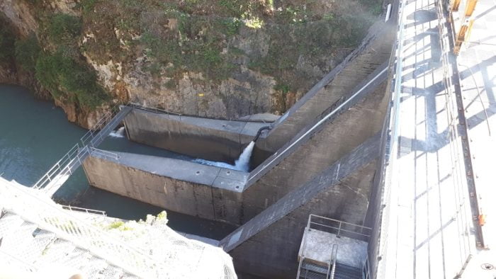
Dam in Lake Lessoc
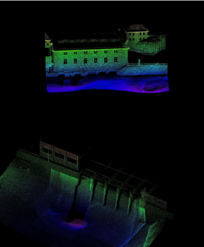
Combination of LiDAR and multibeam data
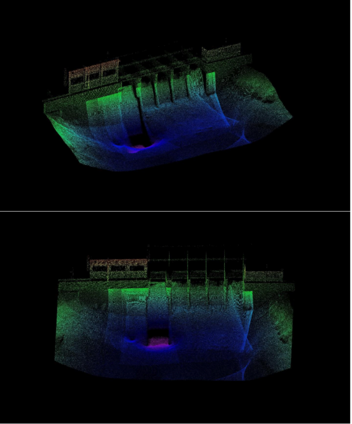
LiDAR and multibeam data of Lessoc Dam
Operating a multi-sensor survey, collecting both bathymetric and LiDAR data at the same time, saved time and money. A particular advantage was that the sensors use a common navigation system and time stamp, ensuring that there was no discrepancy between the two datasets. (This might occur if they were collected days or months apart.). Ultimately this enabled the two datasets to be accurately and easily fused together.
This case study demonstrates the benefits of LiDAR for marine applications such as inshore, nearshore and inland waterway hydrographic surveys. The ability to collect data from multiple sensors, to fuse the resultant data and supplement areas where one dataset is limited, ensures a detailed 3D map can be produced to inform the final output.
Read more about:
- Velodyne Puck LiDAR sensor
- Seabed iLiDAR Laser sensor
- Hydrographic survey applications for LiDAR