Maritime & waterways
Point cloud survey in the maritime and waterways industry to develop smart marinas, manage capacity and enable safe navigation.
Find out more todayMaritime & waterways applications
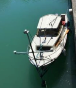
Point cloud survey is valuable in ports, harbours and waterways to develop smart marinas, manage traffic and capacity and ensure safe navigation.
1. LiDAR systems
a) Smart marinas:
Volume and vessel classification in and out of ports and harbours.
Required outcomes:
- To plan and modify infrastructure of ports, harbours and waterways.
- To enable capacity management.
Products: Auriel Record and Purepoint Pro software.
Required outcomes:
- Real-time monitoring of marina capacity.
- Real-time monitoring of traffic in ports and harbours.
Products: Auriel Real-time and Purepoint Pro software.
b) Vessel traffic monitoring:
Volume, flow and classification of vessel traffic along rivers, at bridges, locks and docks.
Required outcomes:
- To improve the safe navigation of waterways;
- To monitor water quality.
Products: Auriel Record and Purepoint Pro software.
Required outcomes: Real-time monitoring of marine traffic to ensure the safe navigation of waterways.
Products: Auriel Real-time and Purepoint Pro software.
2. LiDAR sensors
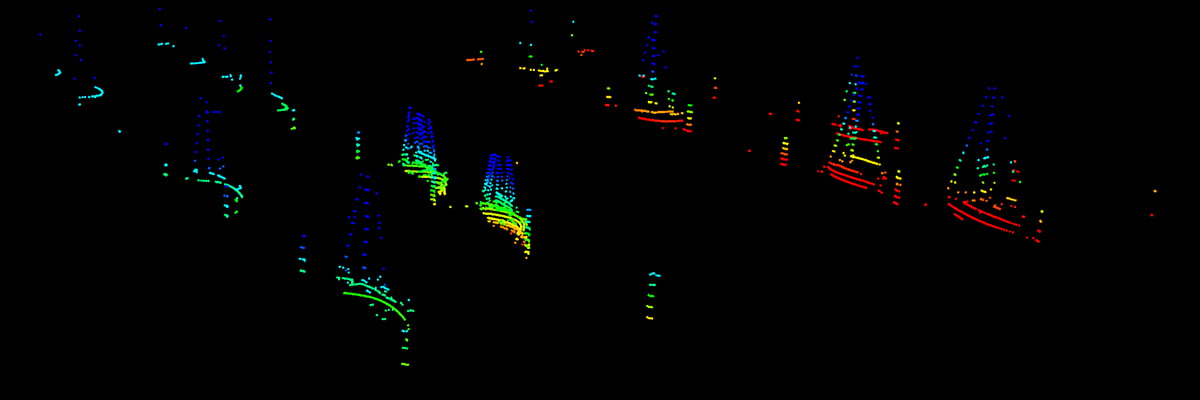
Hydrographic survey: For inshore, nearshore and inland waterway surveys by recording 3D point clouds above the water line. This data complements and can be collected at the same time as underwater sensor data such as single or multibeam echo-sounders, sub bottom profilers and sidescan sonar.
To create a complete picture of above and below the waterline.
The hydrographic software packages which already support Hesai LiDAR products include Teledyne PDS, Foreshore technology, HYPACK, QINSy and EIVA which include Plug & Play support enabling time-synchronisation between the LiDAR scanner and the main navigation system.
Unmanned Surface Vessels (USVs): Autonomous vessels require a high degree of perception similar to that in autonomous cars. LiDAR is utilised for perception, object detection and collision avoidance. Applications for USVs include hydrographic and oceanographic surveys in coastal waters, autonomous river barges, automated ferries, workboats and patrol boats.
To provide real time object detection to help prevent collisions on the water. LiDAR scanners work in any light conditions and have the ability to detect smaller objects and in greater detail than Radar.
Products
Case studies
Read how SeaBed B.V. optimised dredging operations at two silted reservoirs in Switzerland.